
News Summary
As Tropical Storm Helene intensifies and heads towards Florida, residents are urged to stay informed and prepared. With storm surge watches and potential flash flooding in effect, this weather system poses threats to both the Lower and Middle Keys. Despite a brewing disturbance in the North Atlantic, no immediate effects are expected in Jacksonville, though gale force winds may challenge boaters. Stay alert as authorities continue to monitor the situation closely.
Stormy Times Ahead! Florida Prepares for Tropical Weather Challenges
As the sun rises on the vibrant city of Jacksonville, folks are keeping a close eye on the latest weather updates as the National Hurricane Center is monitoring a low-probability disturbance brewing out in the North Atlantic. This doesn’t seem like it’s going to be much of a worry, with only a 10% chance of it turning into something significant over the next seven days.
The disturbance, located about 700 miles northeast of the Leeward Islands, is currently associated with disorganized showers and thunderstorms. Unfortunately for this weather blob, it’s destined to move northwestward into an area that’s known for high wind shear and dry air, which are not the ingredients for a tropical development feast. Basically, it translates to a big “no” on the weather excitement scale.
For the residents living here on the First Coast, it’s shaping up to be a relatively calm week as no formation or impacts are anticipated from this system. However, do note that the system is producing galloping gale force winds exceeding 40 mph. This could make things a bit dicey for any boaters out there, so it’s wise to stay safe and avoid venturing into choppy waters.
Interestingly, while March is not typically the month one thinks of for hurricanes, history tells us that tropical disturbances have been known to pop up during this time. On that note, as we look forward to the 2025 Atlantic Hurricane Season, it’s worth noting that the first named storm is set to be called “Andrea”!
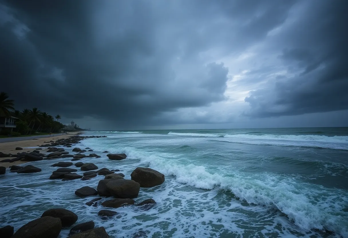
Tropical Storm Helene Takes Center Stage
Now, shifting gears to more pressing news—enter Tropical Storm Helene, which has officially been named as the 8th storm of the 2024 season! Helene is ramping up and is predicted to reach category 3 status, which can make even the hardiest among us a little uneasy.
Expected to make landfall along the Big Bend of Florida on Thursday night, residents in the Lower and Middle Florida Keys should brace themselves as warnings have been issued. A Storm Surge Watch is in effect, indicating that we might see some life-threatening inundation from rising water making its way inland over the next couple of days.
Adding to the urgency, a Tropical Storm Warning has been set in place, signaling that tropical storm conditions are expected within the warning areas over the next 36 hours. Wow, lots of jargon, but what does it mean for you? In practical terms, expect rainfall amounts between 4 to 8 inches in western Cuba and the Cayman Islands, with isolated spots potentially getting up to a whopping 12 inches. The southeastern U.S. is also in for some significant rainfall too, leading to an increased risk of flash flooding and moderate river flooding—definitely not what you want to see!
Don’t forget about the potential flooding! Helene’s storm surge, combined with high tides, could lead to flooding in areas that usually enjoy dry conditions. Also, hurricane conditions could impact parts of Cuba and Mexico, while tropical storm conditions are already knocking on their door.
For beachgoers, beware! Helene is expected to whip up dangerous surf and rip current conditions along Florida’s west coast and the northeastern Gulf Coast, creating a challenging environment for swimming and boating.
Keeping an Eye on the Tropics
As if that wasn’t enough, the National Hurricane Center is also keeping tabs on three additional tropical systems, including a newly-formed tropical depression. So stay tuned, folks! With the weather behaving so unpredictably, watching the skies and keeping abreast of the latest updates is your best bet.
In conclusion, whether it’s a minor disturbance or a major storm headed your way, it always pays to be prepared and stay informed. Keep an eye on your local forecasts, stay safe, and enjoy the rest of your day in brilliant Jacksonville!
Deeper Dive: News & Info About This Topic
HERE Resources
Gulf Coast Prepares for Tropical Disturbance Invest 97L
Additional Resources
- Action News JAX: Tropical Storm Helene Forms
- News4JAX: Tropical System Development Chances
- Jacksonville.com: Forecast for Potential Tropical Cyclone
- Jacksonville.com: Tropical Storm Leslie Updates
- Wikipedia: Hurricane